


sunday, may 04, 2003
early cells in northeast ks including effingham supercell
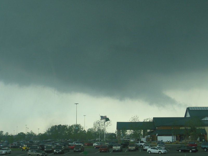
wyandotte county mesocyclone, rfd cut, and tornadogenesis


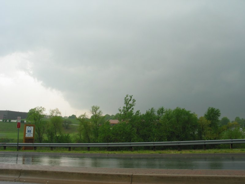
maturation of tornado, including a short-lived twin


rear flank of supercell including numerous lowerings and a few non-tornadic spinups; damage path across i-635


now-elevated supercell exiting kansas city metro; distant supercell to the south


route/tornado tracks and radar imagery


21Z rough guess sounding for Kansas City, KS (based on 18Z TOP RAOB)
Sfc T/Td: 75/69 F
MLCAPE: 2831 J/kg
MLCINH: 6 J/kg
0-3 km MLCAPE: 73 J/kg

chase log:
| the range of emotions i experienced during this chase is indescribable. may 4 was the first and deadliest day in a week of record-breaking tornadic activity. the challenge, aside from keeping up with break-neck storm speeds, would be maximizing chase time in the restricted warm sector while being wary of river crossings and metro areas. i made it to the target town of horton, kansas by 1:00pm, and the low clouds were just beginning to break. the first storm formed rapidly to my south; it was well-structured and accompanied by quarter-sized hail, but the environment was still cold. my instinct was to rush south and east before everything outran me. i left one more cell behind near oskaloosa, and then drove back toward kansas city on i-70. visibility was worsening again, and east of lawrence i encountered moderate rain. not sure how much heating had occurred, nor of where the warm sector began and ended, i was beginning to smell a bust. as i neared the western edge of the metro, a tornado warning was issued for what was to be the northern of a pair of supercells heading toward kansas city. i plotted an intercept. not long after crossing the missouri river on i-435, reports of multiple tornadoes on i-70—in an area i'd passed through not 30 minutes before—came over the weather radio. confused, i headed back south, unable to make out any structure. eventually a monstrous inflow band came into view, which led me to a large wet updraft structure to the southwest of the parallel parkway exit. after dropping south to the next exit, i observed the most ridiculously fast and intense rfd erosion. an enormous, sloped wall cloud was subsequently revealed. tornadogenesis was underway, and appeared to stem from the rfd slot in front of the occluding wall cloud. after a period of rapid intensification, the tornado scattered into an array of multiple vorticies as it crossed the interstate. i headed east on state avenue in an attempt to pace the storm, but within five minutes lost anything more than rare glimpses through trees. the tornado had already produced brief f4 damage. after trailing behind the storm for over an hour, i turned south in pursuit of the next supercell. i gave up somewhere southeast of belton; had i persisted i would have caught it eventually, as it was longitudinally well behind the kansas city area supercells. |